Google Earth marked its 20th anniversary Tuesday by introducing historical Street View imagery directly within the platform, allowing users to virtually time-travel through decades of street-level photography that was previously available only through Google Maps. The update also brings artificial intelligence-powered insights to professional users across the United States, including data on urban tree canopy coverage and land surface temperatures.
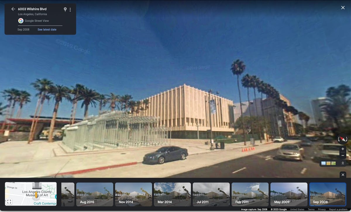
The historical Street View feature enables users to explore how neighborhoods, landmarks, and cities have transformed over time by accessing imagery dating back as far as 80 years in select locations. Users can now witness construction projects unfold, observe urban development, and revisit familiar places from years past directly within Google Earth's immersive 3D environment.


The timing coincides with last year's viral #somewhereonGoogleMaps trend, where social media users shared emotionally resonant discoveries of childhood homes and deceased relatives captured in older Street View imagery12. Google acknowledged this phenomenon as inspiration for bringing the time-travel capability to Google Earth, where the bird's-eye satellite views can now be combined with street-level historical perspectives1.
For professional users, the AI-driven insights utilize Gemini capabilities to provide urban planning data2. In Austin, Texas, for example, city planners can identify areas with substantial tree coverage and pinpoint locations that could benefit from cooling strategies, while also accessing land surface temperature information to determine which neighborhoods experience higher heat12.
Google Earth launched in June 2005 following the company's acquisition of Keyhole, Inc., and achieved 100 million downloads within its first week12. The platform has since evolved from a simple satellite imagery viewer to a comprehensive geospatial tool featuring billions of images across aerial photography, satellite imagery, Street View, and 3D visuals3.
Usage has remained robust, with Google reporting more than 2 billion place searches on Google Earth in the past year alone14. The platform has been utilized for disaster response, archaeological discoveries, and environmental research throughout its history5.
The historical imagery feature had previously been available through Google Maps, but according to CNET, the integration with Google Earth "makes it more immersive and accessible" due to the platform's 3D visualization capabilities6. The AI-powered professional tools will roll out to U.S. users in the coming weeks6.
To access the new historical view features in Google Earth, users can navigate to the Layers menu and scroll down to find the "Historical imagery" layer for aerial and satellite views.1 For Street View time travel, simply drag the pegman icon onto a street, click "see more dates," and use the film strip menu to select different years.2 The feature allows exploration as far back as 1985 in some locations, with availability varying by region.3
The 20th anniversary update also introduces AI-driven insights for professionals, expected to roll out in the coming weeks. These tools will provide valuable environmental data including tree canopy coverage, surface temperature measurements, and rooftop reflectivity analysis to support urban planning decisions.34 For example, in Austin, Texas, users will be able to identify areas with more tree cover and spots that might benefit from cooling approaches to address urban heat islands.4 Currently, these professional features appear to be limited to users in the United States.3